

Applications Toolbox
Below are the tools developed and delivered by the SCO projects.
Raising awareness about climate change and EO
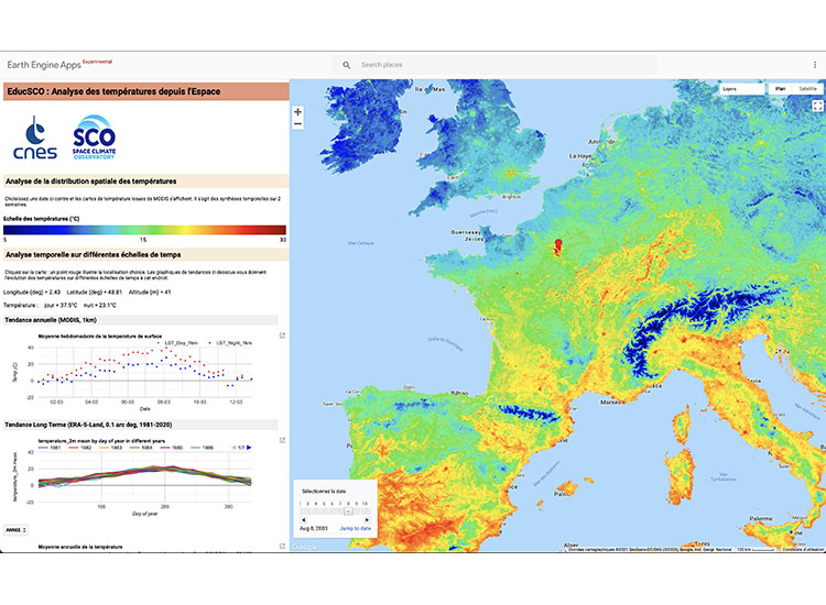
EducSCO is a cross-disciplinary, ongoing project aimed at disseminating knowledge throughout society and raising awareness of climate change issues. It provides a wealth of educational resources, including three flagship apps:
- Middle school level: EducSCO Weather and Climate
- High school level: EducSCO-temperature
- To raise awareness in regions about the potential of satellite imagery: Earth as seen by Sentinel-2
🟢 Free access
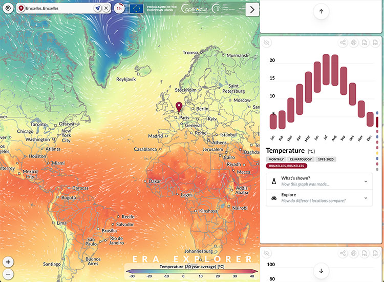
Global climate data accessible to all
Based on ERA5 climate monitoring datasets, this interactive application allows us to explore 85 years of data providing climatological averages around the globe just by clicking any point on the map or using the search bar. It is produced by ECMWF as part of the EU Copernicus Climate Change Service.
🟢 Free access
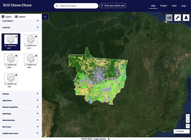
Monitoring territorial dynamics
Developed in the Mato-Grosso region (Brazilian Amazon), the Chove-Chuva demonstrator offers a map-based summary of the territorial dynamics observed in relation to the adaptation and mitigation strategies put in place.
Using multisource data, the tool can produce a 'dashboard' of the territorial situation for an area predefined by a user, based on synthetic indicators covering 4 major themes: climate (rainfall), forest cover, water (hydrology) and agriculture (surface area and practices).
🟢 Free access
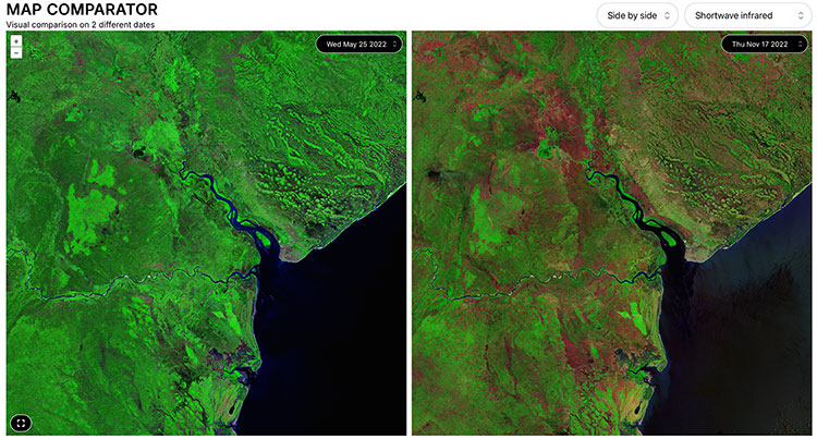
Visualize environmental changes in the most sensitive hotspots
Developed as part of the United Nations Environment Programme's Global Resource Information Database (UNEP-GRID), the EHOP platform is designed to highlight major environmental changes around the world. The prototype already allows users to explore more than 150 sites, comparing satellite images taken on different dates. Advanced features are currently being integrated.
🟢 Open access