

Applications Toolbox
Below are the tools developed and delivered by the SCO projects.
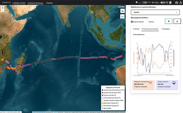
Monitoring cyclonic impacts in the Indian Ocean
Cimopolée is an interactive web mapping service for monitoring the impact of cyclones in the south-west Indian Ocean. Clear and intuitive, the tool displays the presence and trajectory of a cyclone in the OI zone in real time and provides more comprehensive information on the major cyclones of the last ten years. The data and associated background information can be downloaded for more detailed analysis using GIS or statistical software.
🟢 Free access
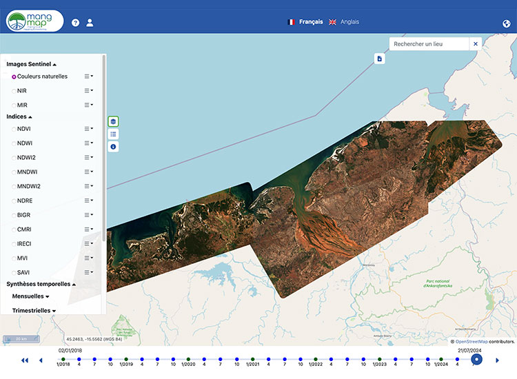
Mangrove operational monitoring
Developed as part of the Mangroves project, MangMap is a mapping portal for operational satellite monitoring of mangroves, designed for scientists and institutional players working to preserve and enhance this ecosystem.
Based on standardized products produced continuously from Sentinel-2 time series since 2018 (10 m resolution, renewed every 5 days), the platform provides an interactive dashboard of environmental information at local scales and offers services on demand to users.
🟢 Free access, you need to create a local account (or use your Theia account) to benefit from the full range of services.
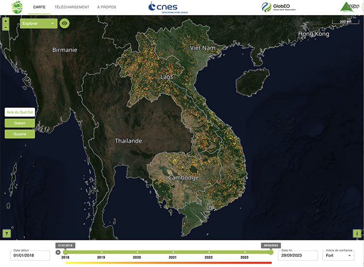
Monitoring tropical deforestation
The Tropisco platform provides a near-real-time view of tropical deforestation from 2018 to the present day. Its maps of forest cover loss are updated every 6 to 12 days using radar images from the Copernicus Sentinel-1 satellite.
Aiming for global coverage, Tropisco currently monitors the forests of 7 countries (French Guiana, Suriname, Guyana, Gabon, Vietnam, Laos and Cambodia), which were used to develop the tool.
🟢 Free access