

Applications Toolbox
Below are the tools developed and delivered by the SCO projects.
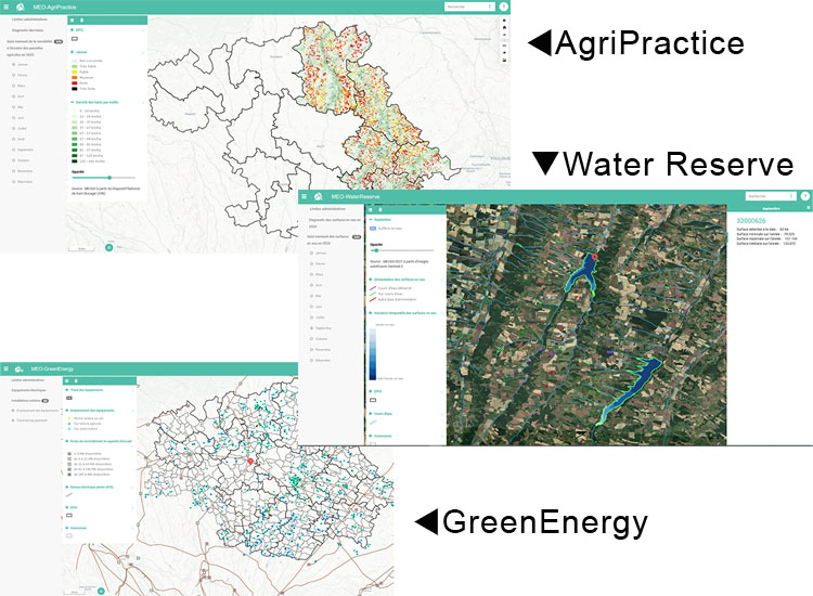
Supporting the transformation of rural areas
The fruit of the Meo-Climate project, MEOSS offers 3 web mapping interfaces:
- AgriPractice, whose indicators help decision-makers to implement measures to adapt to agricultural soil erosion;
- WaterReserve, which centralises a panel of indicators dedicated to intra- and inter-annual monitoring of water surfaces;
- Meo-GreenEnergy, a tool for detecting and optimising the siting of photovoltaic panels.
🔵 Marketed services, accessible by account and password.
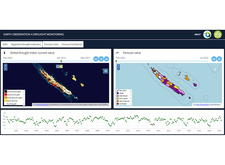
A tool for characterising, monitoring and forecasting drought on a regional scale
An information display and distribution platform developed by InSight, the indicators put in place provide institutions with an objective, up-to-date, spatialized and temporal response to the drought phenomenon.
Developed in New Caledonia, the tool also helps farmers to manage their crops in a rational way, by enabling them to monitor the situation as closely as possible, in line with environmental conditions and changes in them. InSight is now working on extending the tool to other territories and extending its functionalities.
🔵 EO4DM is a commercial service and requires an account and password.
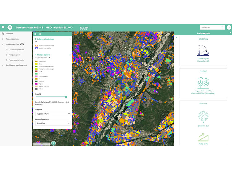
Monitoring irrigated plots and their crop rotation
MEO-Irrigation is a web mapping interface that can be used to extract quantitative indicators to monitor crop irrigation and assess the total surface area irrigated in order to anticipate water requirements and tensions. Working with Sentinel-1 radar and Sentinel-2 optical data at plot level, the system aggregates its data to produce statistics and analyses at commune, canton and even catchment level.
MEO-Irrigation thus completes the MEOSS WaterManagement range of services.
🔵 A commercial service, access requires an account and password.
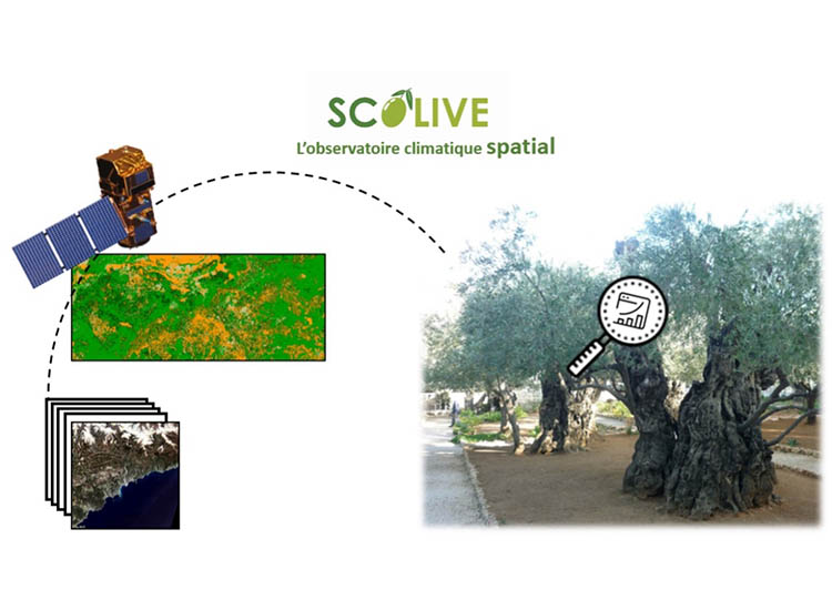
An olive tree observatory, a bioindicator of climate change
SCOLive has set up an observatory to better understand the conditions under which olive tree diseases appear and to anticipate treatments. In doing so, it uses changes in the condition of trees as a marker of climate change.
As a community project, it relies on a mobile application that provides geolocated, time-stamped information. The whole system has great potential for geographical expansion.
🟢 Free access
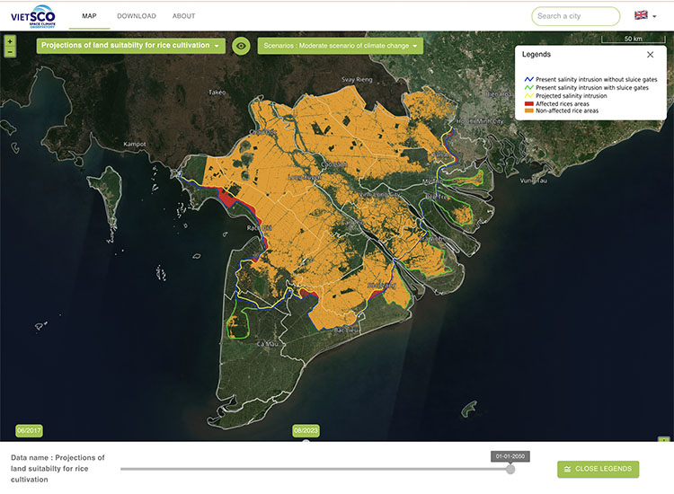
Dynamic monitoring of rice crops
Entirely based on radar imagery, the VietSCO platform, the result of the Vimesco-rice and Viet-ARRO projects, offers a set of maps to support the resilience of rice growing in Vietnam in the face of climate change phenomena.
It provides seasonal maps of rice cultivation and annual intensity, maps of flood extent and duration, and projections of land suitability for rice cultivation under different climate change scenarios.
🟢 Free access