

Applications Toolbox
Below are the tools developed and delivered by the SCO projects.
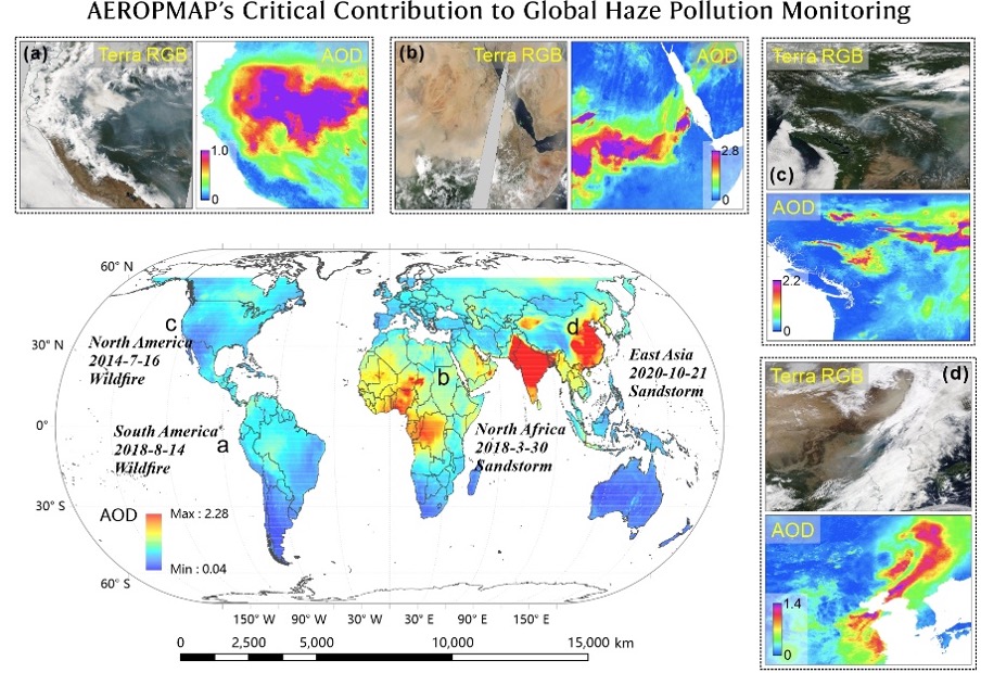
AEROsol and Particulate Matter MAPping
AEROPMAP provides daily global maps of aerosol optical depth at 1 km and PM2.5 by merging satellite and in situ data using deep learning. Updated in near real time, the products are intended for various applications, including air quality monitoring, health risk analysis and climate modelling.
🟢 Products available via an open data platform
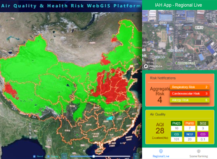
Early Warning Service of Health Risks due to atmospheric pollutionClimate change is driving more frequent and severe abnormal weather, worsening air pollution. The EWSHR project has developed two online services for monitoring and providing early warnings about air quality and health risks: the AQHR WebGIS platform for governments, NGOs, and scientists, and the IAH App usable by everyone.
🔵 Commercially available service. Users can create an account via the login interfaces.
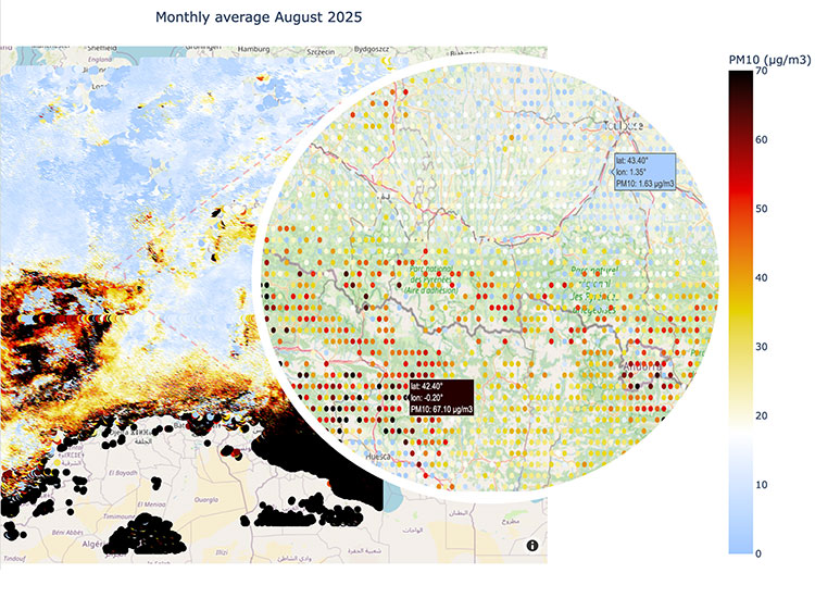
Large-scale automatic monitoring of PM10
Developed by THALES Digital Services, FLORIA is an operational service capable of generating maps of PM10 concentrations on a European scale. Case studies demonstrate FLORIA’s value for analyzing the impacts of climate change, urban planning, and public decision-making, particularly for evaluating traffic management policies.
🔵 Commercialized service
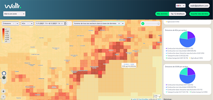
Dynamic inventory of atmospheric emissions
Developed as part of the EDISON project, the GEMS platform enables users to visualize, analyze, and take action regarding emissions of CO₂, NO₂/NOx, and fine particulate matter (PM2.5, black carbon, organic carbon). Hourly emissions mapping, location and temporal tracking of major sources and hotspots, simulation of the impact of public policies (traffic restrictions, boiler conversions, etc.), and comparisons between regions: its various functions make it a powerful tool for identifying concrete levers for reducing emissions, tailored to local specificities. GEMS is easily adaptable for international use.
🔵 Commercialized service